
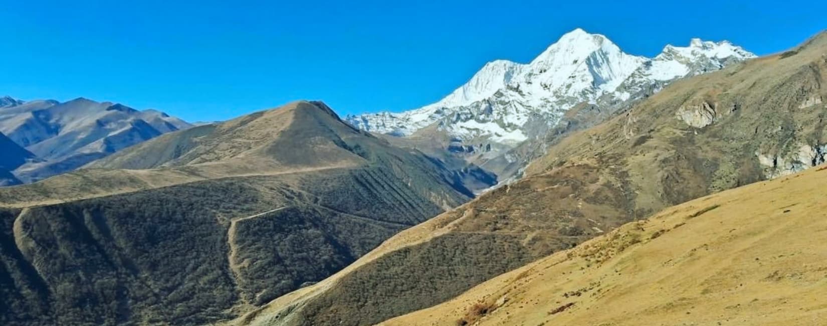
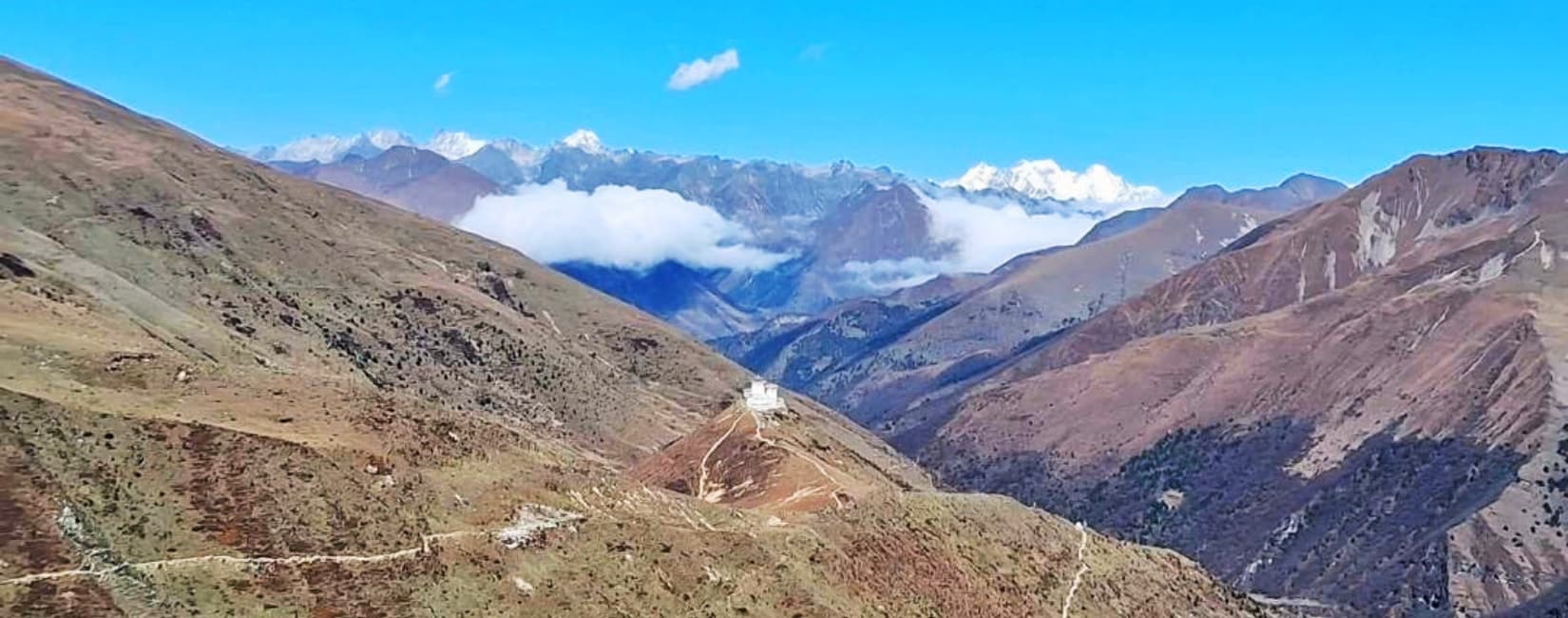
- Four High Mountain Passes: Cross the challenging Nyile La (4,890m), Gobu La (4,410m), Jerela (4,760m), and Shinche La (5,000m) for unparalleled alpine vistas.
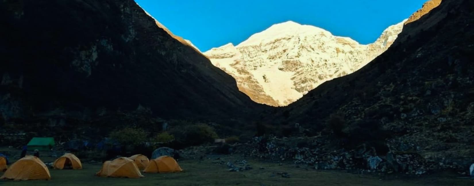
- Jomolhari Base Camp: Camp beneath the imposing, glacier-draped eastern face of Mount Jomolhari (7,326m) at Jangothang.
- Laya Village Immersion: Interact directly with the Layap community, observing their distinct bamboo hats, woven clothing, and semi-nomadic yak-herding lifestyle.
- Gasa Hot Springs Recovery: Reward your intense physical exertion with a therapeutic soak in the mineral-rich geothermal waters of Gasa.
- Tiger's Nest Acclimatization: Start the adventure by hiking to Paro Taktsang, Bhutan's most sacred and architecturally astonishing cliffside monastery.
Laya Gasa Trek in Bhutan
- DestinationBhutan
- Duration17 Days
- GradeDifficult
- ActivitiesTrekking
- AccommodationTents
- Max. Elevation5000m.
- Group SizeMin. 4 Pax
- VehicleLand
- MealsB, L & D
- undefinedEnglish
Trip Highlight
Laya Gasa Trek in Bhutan
Trail Details
Journey Through Laya Gasa Trek in Bhutan
The Laya Gasa Trek in Bhutan represents one of the most visually stunning and culturally immersive trekking routes in the Himalayas. Spanning 17 days, this journey takes you deep into the isolated northern borders of Bhutan. Far removed from standard tourist trails, this expedition challenges trekkers with significant high-altitude mountain passes while rewarding them with profound interactions with the semi-nomadic Layap people. Designed for physically prepared adventurers, the trek combines the majestic alpine geography of the Jomolhari region with the restorative geothermal activity of the Gasa hot springs.
Route Overview
The journey starts with vital acclimatization in the historic Paro Valley, highlighted by a hike to the iconic Tiger's Nest Monastery. From the ruins of Drugyel Dzong, the trail strikes north, following the Paro River toward the towering Mount Jomolhari. After reaching the spectacular Jangothang Base Camp, the route pivots east, crossing a series of formidable high-altitude passes including Nyile La (4,890m), Gobu La (4,410m), Jerela (4,760m), and Shinche La (5,000m). The path winds through remote settlements like Lingzhi, Chebisa, and the high-altitude village of Laya, before gradually descending through dense bamboo and alpine forests to the therapeutic hot springs of Gasa. The trek concludes with a scenic drive through Punakha to the capital, Thimphu.
Peaks and sites seen during the trip
- Paro Taktsang (Tiger's Nest Monastery): A sacred Buddhist site clinging to a vertical cliff 900 meters above the Paro Valley, serving as a critical acclimatization hike.
- Drugyel Dzong: A historic fortress in ruins that originally defended Bhutan from northern Tibetan invasions, marking the official trailhead.
- Mount Jomolhari (7,326m): Known as the "Bride of Kangchenjunga," this sacred peak forms a breathtaking backdrop at the Jangothang campsite.
- Jichu Drake (6,714m): A sharply pointed, glaciated peak visible alongside Jomolhari, presenting some of the most dramatic mountain architecture in the region.
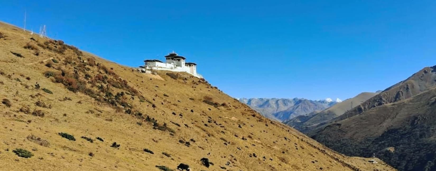
- Lingshi Dzong: An ancient, isolated fortress that historically controlled the travel and trade routes between Bhutan and Tibet.
- Laya Village: One of the highest human settlements in Bhutan, distinct for its conical bamboo hats and unique indigenous semi-nomadic culture.
- Gasa Hot Springs (Tsachu): Natural geothermal springs revered by locals for their therapeutic and healing mineral properties.
- Punakha Dzong: Known as the "Palace of Great Happiness," this massive architectural marvel sits at the confluence of the Pho Chhu and Mo Chhu rivers.
Table of Altitude & Highlights
|
Location |
Altitude |
Major Highlight |
|
Paro |
2,235m (7,331ft) |
Arrival in the historic valley and National Museum |
|
Tiger's Nest |
3,120m (10,236ft) |
Iconic cliffside monastery and acclimatization |
|
Shana |
2,850m (9,350ft) |
First wilderness campsite along the Paro River |
|
Sio Thangthangkha |
3,750m (12,303ft) |
Meadow camping surrounded by alpine forests |
|
Jangothang |
4,050m (13,287ft) |
Direct panoramic views of Mount Jomolhari |
|
Lingshi |
4,100m (13,451ft) |
Crossing Nyile La Pass (4,890m) and Lingshi Dzong |
|
Chebisa |
3,850m (12,631ft) |
Quaint village life and a scenic cascading waterfall |
|
Shomuthang |
4,130m (13,549ft) |
Crossing Gobu La Pass (4,410m) |
|
Robluthang |
4,160m (13,648ft) |
Crossing Jerela Pass (4,760m) into remote terrain |
|
Lingmithang |
4,140m (13,582ft) |
Crossing Shinche La Pass (5,000m), highest on trek |
|
Laya |
3,850m (12,631ft) |
Unique indigenous Laya culture and village exploration |
|
Koena |
3,800m (12,467ft) |
Dense, pristine forests and rugged trail sections |
|
Gasa |
2,900m (9,514ft) |
Therapeutic natural hot springs and Gasa Dzong |
|
Punakha |
1,200m (3,937ft) |
Majestic Punakha Dzong at the river confluence |
|
Thimphu |
2,320m (7,611ft) |
Bhutan's capital, featuring Tashichho Dzong |
Table of Temperature
|
Location |
Spring (Mar-May) High / Low |
Autumn (Sep-Nov) High / Low |
|
Paro / Thimphu |
20°C / 5°C |
22°C / 4°C |
|
Jangothang (4,050m) |
10°C / -5°C |
12°C / -8°C |
|
Lingshi (4,100m) |
9°C / -6°C |
10°C / -10°C |
|
Laya (3,850m) |
12°C / -2°C |
14°C / -4°C |
|
Gasa (2,900m) |
16°C / 2°C |
18°C / 0°C |
Temperatures are approximate and subject to severe weather changes in high alpine zones.
Trip Alternatives
- Jomolhari Trek: A shorter iteration that reaches the spectacular Jangothang Base Camp but turns back before crossing the high passes to Laya. Perfect for those with less time.
- Snowman Trek: The ultimate Bhutanese expedition. It includes the Laya Gasa route but continues much further into the Lunana region, known as one of the hardest treks in the world.
- Druk Path Trek: A moderate, scenic route connecting Paro and Thimphu, ideal for hikers seeking beautiful mountain lakes without the extreme altitudes of the northern borders.
Elevation Chart
Detailed Itinerary
Laya Gasa Trek in Bhutan - 17 days
- Day 01
Arrival at Paro
Begin your Bhutanese adventure as you land at Paro International Airport, navigating the dramatic mountain approach that makes this flight world-famous. Upon clearing immigration, the dedicated team from Himalayan Planet Adventures will welcome you and transfer you to your hotel. Depending on your arrival schedule, you can spend the afternoon resting to adjust to the sudden elevation or step out to explore the quiet, traditional streets of Paro. If time permits, visit the impressive Paro Dzong, a masterpiece of Bhutanese architecture that serves as both a religious and administrative hub, followed by the National Museum housed in an ancient watchtower. The evening concludes with a comprehensive gear check and briefing from your guide to ensure you are fully prepared for the days ahead.
- MealsDinner Included
- AccommodationHotel
- Travel Duration30 minutes driving
- Travel Distance10km
- RouteParo International Airport to Paro District
- Transportationcar
- Elevation2,235m
- Day 02
Hike to Tiger's Nest Monastery (3,120m)
Start your day with a nourishing breakfast before taking a short drive to the trailhead of Bhutan’s most iconic landmark: Paro Taktsang, widely known as the Tiger’s Nest Monastery. This vital acclimatization hike climbs steeply through pristine pine forests draped in Spanish moss. After a challenging two-hour ascent, you reach the monastery, which miraculously clings to a sheer rock face 900 meters above the valley floor. Explore the sacred shrines where Guru Rinpoche is said to have meditated in the 8th century. After soaking in the panoramic valley views and the deep spirituality of the site, descend the mountain and enjoy a well-earned lunch. Return to your hotel in Paro for a final night in a comfortable bed before the wilderness trekking begins.
- MealsBreakfast, Lunch, and Dinner Included
- AccommodationHotel
- Travel Duration4 to 5 hours hiking
- Travel Distance6km hiking round trip
- RouteParo District to Paro District
- Transportationcar
- Elevation2,235m to 2,235m
- Day 03
Drive to Drugyel Dzong and Trek to Shana
After an early breakfast, drive to the ruins of Drugyel Dzong, an ancient fortress that once defended the valley against Tibetan invasions. On a clear morning, the imposing, snow-covered peak of Mount Jomolhari dominates the skyline behind the ruins. This marks the official starting point of the trek. The trail immediately plunges into the wilderness, following the meandering path of the Paro River. You will hike through lush agricultural fields, traditional farming villages, and dense alpine pine forests. The gradient is relatively gentle today, serving as a physical introduction to the rigors of the trail. Arrive at Shana by late afternoon, where your camp crew will have your first wilderness campsite set up in a serene clearing near the riverbanks.
- MealsBreakfast, Lunch, and Dinner Included
- Travel Duration6 to 7 hours hiking
- Travel Distance17km
- RouteParo District to Shana Samba
- Transportationfoot
- Elevation2,235m to 2,850m
- Day 04
Trek from Shana to Sio Thangthangkha
Wake up to the sounds of the Paro River and enjoy a hot breakfast prepared by the camp chef. Today’s route continues to trace the river upstream, demanding a noticeable increase in physical effort. The trail ascends steadily through thick, ancient alpine forests heavily populated with oak, pine, and vibrant rhododendron trees. The valley narrows significantly, casting deep shadows across the rocky path. As you gain nearly 900 meters in elevation, the air thins, requiring a slow and deliberate pace. By mid-afternoon, you emerge into a stunning meadow at Sio Thangthangkha. If the skies are clear, this campsite offers your first spectacular, unobstructed view of Mount Jomolhari piercing the sky at the head of the valley.
- MealsBreakfast, Lunch, and Dinner Included
- Travel Duration7 to 8 hours hiking
- Travel Distance19km
- RouteShana Samba to Thangthangkha Camp
- Transportationfoot
- Elevation2,850m to 3,750m
- Day 05
Sio Thangthangkha to Jangothang
The trek today pushes higher into the alpine zone, leaving the thick forests behind for expansive mountain meadows. The trail steepens as you hike past remote, stone-walled yak herder camps, providing a glimpse into the resilient high-altitude lifestyle of the local nomads. Keep a close watch on the steep valley walls, as this terrain is prime habitat for herds of Himalayan blue sheep. You will cross the 4,000-meter threshold today, a critical altitude benchmark. Arrive at Jangothang Base Camp, arguably one of the most breathtaking campsites in the entire Himalayas. You set up your tent directly beneath the staggering, glaciated eastern face of Mount Jomolhari, flanked closely by the sharp spire of Jichu Drake.
- MealsBreakfast, Lunch, and Dinner Included
- Travel Duration7 to 8 hours hiking
- Travel Distance19km
- RouteThangthangkha Camp to Jangothang
- Transportationfoot
- Elevation3,750m to 4,050m
- Day 06
Acclimatize at Jangothang
At over 4,000 meters, a dedicated acclimatization day is mandatory to allow your body to adapt to the reduced oxygen levels. Rather than sleeping in, the best strategy to combat AMS is to "climb high and sleep low." Take a highly recommended acclimatization hike toward the glacier moraines at the base of Mount Jomolhari or trek up the ridge toward Jichu Drake. These short excursions offer incredible vantage points for landscape photography and increase your chances of spotting Himalayan marmots and blue sheep. Alternatively, explore the twin alpine lakes located just an hour from camp. Return to Jangothang in the early afternoon to rest, hydrate thoroughly, and prepare your gear for the challenging high passes that begin tomorrow.
- MealsBreakfast, Lunch, and Dinner Included
- Travel Duration3 to 4 hours hiking
- Travel Distance4-6km (acclimatization hikes)
- RouteJangothang to Jangothang
- Transportationfoot
- Elevation4,050m to 4,050m
- Day 07
Trek from Jangothang to Lingshi
Today presents the first major test of the expedition. Leave the stunning Jomolhari base camp behind as the trail climbs steeply out of the valley basin. The grueling ascent takes you to the Nyile La Pass at a staggering 4,890 meters. The lack of oxygen makes every step demanding, but the panoramic views from the summit—encompassing Jomolhari, Jichu Drake, and Tshering Kang—are profoundly rewarding. After securing your photographs and catching your breath, begin the long descent into the Lingshi basin. As you approach the campsite, the ancient, formidable structure of Lingshi Dzong comes into view, perched perfectly on a commanding ridge. You will camp in a valley known for high winds, so bundle up as temperatures drop sharply after sunset.
- MealsBreakfast, Lunch, and Dinner Included
- Travel Duration6 to 7 hours hiking
- Travel Distance18km
- RouteJangothang to Lingshi
- Transportationfoot
- Elevation4,050m to 4,100m
- Day 08
Lingshi to Chebisa
Following the rigors of the Nyile La Pass, today offers a relatively moderate and highly scenic day of trekking. The route meanders through rolling hills and expansive alpine pastures, maintaining a relatively steady contour rather than demanding steep climbs. You will pass through several small, isolated settlements where you can observe traditional rural Bhutanese life. The trail eventually descends gently into the idyllic village of Chebisa. The campsite here is spectacular, positioned in a lush green valley directly beside a beautiful, cascading waterfall. Spend the afternoon resting your legs, photographing the waterfall, or interacting with the friendly villagers of Chebisa, who rarely see outsiders outside the main trekking seasons.
- MealsBreakfast, Lunch, and Dinner Included
- Travel Duration5 to 6 hours hiking
- Travel Distance12km
- RouteLingshi to Chebisa
- Transportationfoot
- Elevation4,100m to 3,850m
- Day 09
Chebisa to Shomuthang
Prepare for another challenging day of elevation gain. Leaving the waterfall at Chebisa behind, the trail immediately points upward, demanding a steep and sustained climb toward the Gobu La Pass at 4,410 meters. The ascent traverses vast, high-altitude pastures where you are likely to encounter herds of yaks grazing in the harsh environment. From the top of the pass, the route drops steeply back down into a dense, forested valley, crossing several small streams before climbing once again over a minor ridge. You finally descend into the Shomuthang valley, setting up camp on the grassy banks of a tributary river. Hydrate heavily and rest, as another major pass awaits tomorrow.
- MealsBreakfast, Lunch, and Dinner Included
- Travel Duration6 to 7 hours hiking
- Travel Distance17km
- RouteChebisa to Shomuthang
- Transportationfoot
- Elevation3,850m to 4,130m
- Day 10
Shomuthang to Robluthang
The trek from Shomuthang begins with a grueling, relentless climb toward the Jerela Pass at 4,760 meters. As you grind your way to the summit, look back for sweeping views of the mountains you have traversed over the past week, including distant glimpses of Mount Kangbum. The descent from Jerela is notoriously rugged, navigating steep, rocky terrain that can be treacherous and slippery if there has been recent rain or snow. The trail eventually plunges into a deep, secluded valley, passing through vibrant patches of rhododendron before arriving at the remote campsite of Robluthang. This wild, isolated location sits high above the tree line, offering an incredible stargazing opportunity on clear nights.
- MealsBreakfast, Lunch, and Dinner Included
- Travel Duration5 to 6 hours hiking
- Travel Distance15km
- RouteShomuthang to Camp 7 Robluthang
- Transportationfoot
- Elevation4,130m to 4,160m
- Day 11
Robluthang to Lingmithang
Today you tackle the highest altitude of the entire trek. Start early for the grueling push up to the Shinche La Pass, an exhausting ascent that tops out at 5,000 meters. The thin air will severely test your endurance. Still, the summit provides a supreme sense of achievement and unparalleled, sweeping vistas of the glaciated peaks that form the border with Tibet. Once over the pass, the descent is long, dramatic, and steep. You will drop down through ancient moraines and eventually re-enter the tree line, where the barren rock gives way to lush, dense forests. Arrive at the beautiful riverside campsite of Lingmithang, where the warmer air and thicker oxygen provide immediate physical relief.
- MealsBreakfast, Lunch, and Dinner Included
- Travel Duration7 to 8 hours hiking
- Travel Distance19km
- RouteCamp 7 Robluthang to Lingmithang
- Transportationfoot
- Elevation4,160m to 4,140m
- Day 12
Lingmithang to Laya
Enjoy a much easier trekking day as you follow the river valley downstream toward the famed village of Laya. The trail winds comfortably through thick cedar and pine forests, offering a pleasant and highly scenic walk with minimal altitude gain. Upon arriving in Laya, you immediately notice a distinct shift in culture. The Layap people are semi-nomadic yak herders with a unique language, distinct woven clothing, and iconic conical bamboo hats adorned with beads. Set up camp near the settlement and spend the entire afternoon exploring the village. This is a rare opportunity to engage with a highland culture that has remained largely unchanged for centuries, offering one of the most culturally enriching experiences of the trip.
- MealsBreakfast, Lunch, and Dinner Included
- Travel Duration3 to 4 hours hiking
- Travel Distance10km
- RouteLingmithang to Laya
- Transportationcar
- Elevation4,140m to 3,850m
- Day 13
Laya to Koena
Leaving the cultural richness of Laya behind, the trail plunges back into the deep wilderness. The route initially descends to an army camp at the valley floor before beginning a punishing climb up to the Koena Pass. The trail today is often characterized by thick mud, exposed roots, and rugged, undulating terrain that constantly shifts between steep ascents and sharp drops. You will walk through ancient, moss-draped forests that feel entirely prehistoric. Arrive at the Koena campsite, a quiet, densely wooded clearing that offers deep solitude. Spend the evening resting your legs and enjoying a hot meal prepared by the crew as you prepare for the final long push to Gasa tomorrow.
- MealsBreakfast, Lunch, and Dinner Included
- Travel Duration7 to 8 hours hiking
- Travel Distance19km
- RouteLaya to Koina
- Transportationfoot
- Elevation3,850m to 3,800m
- Day 14
Koena to Gasa
The final trekking day brings a significant and highly anticipated change in scenery and climate. You will briefly ascend to cross the Bari La pass at 3,740 meters before beginning a massive, sustained descent out of the high alpine zone. The trail drops continuously through incredibly dense bamboo jungles and broadleaf forests. As you lose altitude, the temperature rises noticeably, and the air becomes rich and humid. The trek officially concludes as you march into the settlement of Gasa. The ultimate reward awaits you here: the famous Gasa Hot Springs (Tsachu). Spend the afternoon soaking in the natural geothermal pools, letting the mineral-rich waters soothe your exhausted muscles after nearly two weeks of grueling mountain travel.
- MealsBreakfast, Lunch, and Dinner Included
- Travel Duration7 to 8 hours hiking
- Travel Distance18km
- RouteKoina to Gasa District
- Transportationfoot
- Elevation3,800m to 2,900m
- Day 15
Drive from Gasa to Punakha
After a final morning soak in the hot springs and a hearty breakfast, you officially trade the trekking trail for a vehicle. Board your private transport for the scenic, winding drive down from the mountains into the warm, subtropical valleys of Punakha. The rough mountain road offers dramatic drops and sweeping views of the lush, terraced hillsides. Arrive in Punakha, the ancient winter capital of Bhutan, and check into a proper hotel—your first real bed and hot shower in two weeks. In the afternoon, visit the magnificent Punakha Dzong, situated perfectly at the confluence of the Mo Chhu and Pho Chhu rivers. It is widely considered the most beautiful fortress in the country.
- MealsBreakfast, Lunch, and Dinner Included
- AccommodationHotel
- Travel Duration2 to 3 hours driving
- Travel Distance75km
- RouteGasa District to Punakha District
- Transportationcar
- Elevation2,900m to 1,200m
- Day 16
Punakha to Thimphu
Enjoy a leisurely breakfast before beginning the drive to Thimphu, the modern capital of Bhutan. The road climbs steadily back up the mountains, eventually crossing the famous Dochula Pass at 3,100 meters, adorned with 108 memorial chortens and offering sweeping views of the eastern Himalayas. Arrive in Thimphu and check into your hotel. Spend the afternoon exploring the city’s unique blend of traditional culture and modern development. Visit the massive Buddha Dordenma statue overlooking the valley, explore the Folk Heritage Museum, and witness the impressive architecture of the Tashichho Dzong. In the evening, wander the vibrant streets to shop for authentic Bhutanese handicrafts and textiles, celebrating the successful completion of your epic journey.
- MealsBreakfast, Lunch, and Dinner Included
- AccommodationHotel
- Travel Duration2 to 3 hours driving
- Travel Distance76km
- RoutePunakha District to Thimphu
- Transportationcar
- Elevation1,200m to 2,320m
- Day 17
Thimphu to Paro and Departure
On your final morning in Bhutan, enjoy a relaxed breakfast at your hotel in Thimphu. Depending on your flight schedule, you may have time for some last-minute souvenir shopping or a final stroll through the city center. Board your vehicle for the short, scenic drive back to Paro International Airport. The drive follows the Wang Chhu and Paro Chhu rivers, offering one last look at the pristine Bhutanese landscape. Arrive at the airport with ample time for check-in. Bid a fond farewell to your guide and driver, carrying home unforgettable memories of the high passes, the resilient Layap people, and the incredible beauty of the Laya Gasa Trek.
- MealsBreakfast Included
- Travel Duration1 hour driving
- Travel Distance50km
- RouteThimphu to Paro International Airport
- Transportationcar
- Elevation2,320m to 2,235m
If the provided schedule isn't suitable for you, we can create personalized travel arrangements.
Customize My TripTrekking Guide
Everything you need to know
Trip Grades
This is a Strenuous / Demanding trek. You will be walking for up to 8 hours a day over rugged, uneven terrain, repeatedly crossing mountain passes that are near or exceed 5,000 meters.
Physical Requirement and Health
Participants must be in excellent cardiovascular health and possess strong lower body endurance. You must be capable of sustained physical exertion at high altitudes where oxygen levels are significantly reduced. Individuals with pre-existing heart or respiratory conditions must consult a physician.
Training program
Begin a dedicated training regimen at least three to four months before arrival. Focus on cardiovascular endurance (running, cycling, swimming) and lower body strength training (squats, lunges). Crucially, undertake long day hikes (6-8 hours) wearing your trekking boots and carrying a 5- 7 kg daypack to simulate trail conditions.
Age Limit
Due to the extreme altitude and isolation, the recommended age limit for this trek is 16 to 65 years. Older participants with verifiable high-altitude trekking experience may be considered upon medical clearance.
Group size
We operate with a minimum of 4 and a maximum of 12 participants. A smaller group size ensures personalized attention from the guide, better safety monitoring, and a lower environmental impact on remote campsites.
Best time to visit
The optimal trekking windows are Spring (March to May) and Autumn (September to November). Spring offers blooming rhododendrons and warmer days, while Autumn provides the clearest skies for mountain photography. Winter (December to February) brings heavy snow blocking the passes, and Summer (June to August) brings monsoon rains, mud, and leeches, making the trail impassable.
Visa Information
Bhutan requires a pre-approved tourist visa for all international travelers (excluding Indian nationals). Himalayan Planet Adventures handles the entire visa application process upon booking. The visa fee is $40, and the visa clearance letter must be presented upon boarding your flight to Paro.
Necessary Permits
All required trekking permits, route clearances, and National Park entry fees (Jigme Dorji National Park) are arranged by our team and are included in the package. You do not need to apply for these independently.
Insurance details
Comprehensive travel insurance is mandatory. Your policy MUST cover high-altitude trekking up to 5,500 meters and specifically include emergency helicopter evacuation and medical repatriation. Policies can be purchased from providers like World Nomads, Global Rescue, or through your national automobile association (e.g., AAA, ADAC).
Transportation and/or Domestic Flight
All ground transportation in Bhutan is conducted in well-maintained, private vehicles. For group sizes of 4-6, a 07/10-seater HiAce bus or high-roof vehicle is used. Roads in Bhutan are winding and mountainous; motion sickness medication is recommended for susceptible travelers.
Vehicle Envisaged:
|
Group size |
Vehicle type |
Seating capacity |
|
4-6 Pax |
HiAce bus/High roof |
07/10-Seater including driver |
Packaging and Luggage Information
Pack in layers. You will need moisture-wicking base layers, a heavy down jacket for sub-zero nights, and completely waterproof outer shells. Your main luggage will be carried by pack animals (yaks or mules). You will only carry a daypack (30-40L) containing daily essentials: water, snacks, camera, and rain gear.
Porter service
In Bhutan, heavy logistics, camping equipment, and duffel bags are transported by yaks, mules, and a dedicated camp crew rather than traditional human porters. The crew handles all camp setup, dismantling, and cooking, allowing you to focus entirely on trekking.
Accommodation, meals, and water
In Paro, Thimphu, and Punakha, you will stay in comfortable 3-star equivalent hotels. On the trek, you will sleep in high-quality 2-man tents. All meals are provided. The trekking chef prepares fresh, energy-dense meals (a mix of Bhutanese, Indian, and Continental). Drinking water is boiled and filtered by the camp staff every morning and evening for safe consumption.
|
Destination |
Names of Hotels |
Accommodation |
|
Paro |
Mandala/ similar-2nights |
Hotel |
|
Trek starts: Shana |
Trek |
Camp |
|
Thangthangkha |
Trek |
Camp |
|
Jangothang |
Trek-2 Nights |
Camp |
|
Lingzhi |
Trek |
Camp |
|
Chebisa |
Trek |
Camp |
|
Shomuthang |
Trek |
Camp |
|
Robluthang |
Trek |
Camp |
|
Lingmithang |
Trek |
Camp |
|
Laya |
Trek |
Camp |
|
Koena |
Trek |
Camp |
|
Gasa |
Trek |
Camp |
|
Punakha |
Hotel Lobesa/ similar |
Hotel |
|
Thimphu |
City hotel/similar |
Hotel |
|
Departure |
|
|
Altitude Information, Acclimatization, and AMS safety
Acute Mountain Sickness (AMS) is a severe risk. This itinerary includes a dedicated acclimatization day at Jangothang. Our guides are trained in high-altitude first aid and carry medical oxygen and oximeters. You must hike at a slow, steady pace ("Bistari"), stay highly hydrated, and immediately communicate any symptoms of headache, nausea, or dizziness to your guide.
Internet and Phone connectivity
Connectivity is extremely limited. Paro, Thimphu, and Punakha have reliable Wi-Fi and 4G networks. However, once the trek begins past Shana, cellular service disappears almost entirely. Treat the trekking portion of this trip as a complete digital detox.
Currencies acceptable
The Bhutanese Ngultrum (BTN) is pegged to the Indian Rupee (INR). US Dollars are widely accepted in major towns for high-value purchases. Still, you should convert cash into Ngultrum at Paro airport or Thimphu for small purchases, tipping, and use in remote villages like Laya.
Tipping Guidelines
Tipping is a customary way to show appreciation for the hard work of your trekking crew. A general guideline is $150-$200 per traveler, handed to the lead guide at the end of the trek to be distributed among the cooks, animal handlers, and camp staff based on their roles.
Area Guidelines
You are trekking through Jigme Dorji National Park, a protected bio-reserve. Strictly adhere to "Leave No Trace" principles. All non-biodegradable waste must be packed out. Do not disturb wildlife or pick alpine flora.
Photography guidelines and cultural sensitivity
Bhutan is deeply traditional. Always ask permission before photographing locals, particularly the Layap people. Photography inside the inner sanctuaries of Dzongs and temples is strictly forbidden. Dress modestly; shoulders and knees must be covered when visiting any religious or administrative site.
How to Book this trip
To secure your departure, contact Himalayan Planet Adventures Pvt. Ltd. through our website portal. We require a clear scan of your passport (valid for at least 6 months) and a 30% deposit to initiate the visa and permit process.
Trip FAQs
Will I be safe traveling as a solo female trekker in Bhutan?
Yes, Bhutan is widely considered one of the safest countries in the world for female travelers. Our local guides are highly professional and deeply respectful. You will be supported by a dedicated crew throughout the trek, and violent crime against tourists is virtually non-existent.
Do I need to carry my own heavy backpack?
No. You only need to carry a small daypack with your daily water, rain gear, and camera. The heavy camping equipment, food, and your main duffel bag are transported entirely by yaks and mules between campsites.
What happens if I get severe altitude sickness on the trail?
Our guides are trained to identify the early symptoms of AMS. If symptoms persist or worsen, the strict protocol is immediate descent. If you are incapacitated, we coordinate an emergency helicopter evacuation to the hospital in Thimphu, which is why your insurance must cover high-altitude rescue.
Is there electricity to charge my camera at the campsites?
There is no electricity at the remote campsites. You must bring high-capacity power banks or portable solar chargers to keep your cameras and devices powered during the trekking days.
Can I get specialized vegetarian or vegan meals on the trek?
Absolutely. Because Bhutan is a Buddhist country, vegetarian food is very common and high quality. Just inform us during booking, and our camp chef will prepare dedicated, nutritious plant-based meals to keep your energy up.
Customer's words
Traveller Review
Beautiful experience in Nagarkot
Watching the sunrise at Nagarkot was absolutely breathtaking, and our guide made the trek smooth and informative. During the journey, we were able to enjoy the charming villages, stunning natural scenery, and beautiful temples along the way. Our guide was very knowledgeable about Nepal’s culture, nature, and temples, and was attentive and professional throughout the trek.
The transportation and overall organization were reliable, ensuring a comfortable and enjoyable experience.
Overall, it was a well-organized and memorable trek, and I highly recommend their guiding services.30th Dec, 2025 A Perfect Nepal Experience with Himalaya Planet Adventure & the Amazing Guide Ananta🌹
From the very early planning stages , Himalaya Planet Adventure showed incredible professionalism, flexibility, and communication
My guide, Ananta. From the moment I was picked up at the airport, Ananta made me feel like I was traveling with friend— always punctual, full of positive energy, and incredibly knowledgeable about every place we visited. In just a short amount of time, we were able to explore so much of Kathmandu thanks to the smart planning and flexibility. From the breathtaking Chandragiri Hills cable car ride to the Swayambhunath (Monkey Temple), the majestic Boudhanath Stupa, the sacred Pashupatinath Temple, a unique visit to a Kashmiri mosque, and the vibrant squares of Kathmandu Durbar Square, everything was seamless.
To top it all off, we had a wonderful cultural dinner at Gokarna House, complete with live performances
Thank you again to the entire Himalaya Planet Adventure head and team for such an unforgettable journey. I highly recommend this company to anyone visiting Nepal — whether for a day or a week, they will maximize your experience with care, professionalism, and heart.
Sherif, Egypt — Tour in April 2025
13th Apr, 2025 Superb
Stunning and breathtaking , awesome view of the Himalayas, This had been my dream to see Mt. Everest from close quarters. I believe Moutain has always inspired me to be strong , bold , and stand tall amidst crisis. The snow clad mountain ranges was looking as though someone had painted in a canvas . I wish I could actually set my foot on them , walk up to the top and say Ahoy I have arrived .
1st Jul, 2023 Gokyo Trekking
We had a wonderful time in Nepal. Himalayan Planet and our guide Hari were top organised from the airport pickup to the return flight.
Our adventure started with Hari and our porter via the airport Ramechhap (flights from Kathmandu are cancelled increasingly). Hari was always worried about our well-being and tour changes and wishes were accepted without discussion. The selected teahouses were quite good according to the local standard. The food served in the teahouses was always very good (we only had veggie food ).
Himalayan Planet surprised us with a direct helicopter flight from Lukla to Kathmandu after we had arrived in Lukla two days earlier than planned. We heard later that this was the last flight for two days out of Lukla due to the misty weather.
We can highly recommend Hari as a tour guide. He is funny, knows the Everest area very well and is extremely adaptable and kind.
We thank Himalayan Planet for the great organisation and would like to recommend them warmly.
Julia and Miri
19th Dec, 2022 Simply amazing!
Roshan is a very thoughtful, knowledgeable and flexible guide. He has accommodated all of our requests and made our experience memorable. I would definitely book with Roshan again next time I'm back in Kathmandu for tours.
31st Dec, 2021